 Banff City Guide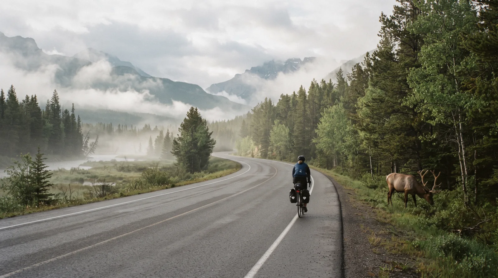
Banff Walks: Flat Miles for Any Morning
Banff walks are the flat answer to the park's big climbs, and this page sorts the easy miles by length, surface and season. If you want the steeper stuff instead, the Banff hiking hub covers the summits. Everything here starts within a short drive or bus ride of the townsite. The whole valley, start to finish: the Banff homepage.
Quick answer The short version on Banff's easy walks
The best flat banff walks are the Bow River trail through town, the Fenland Trail beaver marsh off the Bow Valley Parkway, the Hoodoos viewpoint walk, and the winter list Parks Canada publishes for the Banff area, which includes the Fenland 2.1 km loop and the Marsh Loop at 2.8 km. All are free with a park pass, none need a shuttle booking, and all suit a morning before the day's big plans. For a first evening, the Bow River trail pairs well with the Vermilion Lakes road a few minutes west.
Key takeaways
- Every trail on this page is free to walk. You only need the regular park entry pass, covered on the park pass page.
- Short on time and want the town explained as you go? The Banff Village Walking Tour runs the townsite on foot with a guide.
- Winter walkers should read the avalanche line: Parks Canada states avalanche season in the mountains runs from November to June, so stay on the valley-bottom walks listed on the winter in Banff page.
- Fancy a water angle instead of another trail? The Lake Minnewanka Cruise is an hour on the park's biggest lake, a 20-minute drive from town by the operator's own wording.
The Walks By Length
This table compares the easy Banff-area walks on this page and the nearby flat options Parks Canada lists for the Banff area in winter, so you can match a trail to the time you actually have. All distances come from the official Parks Canada winter walking list, which is the only official source that prints these figures together. Times are our estimate at a relaxed walking pace.
Reading The Table
Pick by clock, not by name. Under two kilometres suits a coffee-stop stretch. Two to four kilometres fills a morning hour.
Anything longer, and you are into half-day territory. Surfaces matter more than length after snow, so check the winter column before you commit.
| Walk | Distance | Terrain | Winter status |
|---|---|---|---|
| Fenland Trail loop | 2.1 km loop | Flat forest track along a beaver marsh | On the official winter walking list |
| Marsh Loop (Cave and Basin side) | 2.8 km | Flat marsh and boardwalk country | On the official winter walking list |
| Spray Connector | 2 km | Flat town-to-river link | On the official winter walking list |
| Stewart Canyon (Lake Minnewanka) | 1.5 km one way | Gentle canyon shore path | Winter walking and snowshoe trail per Parks Canada |
| Bow River trail and the recreation grounds | not stated | Flat gravel riverside paths through town | Town paths, walkable most of the year |
| Hoodoos viewpoint walk | not stated | Rolling riverside path to a valley viewpoint | not stated |
| Tunnel Mountain (if you want one climb) | 2.4 km one way | Steady uphill, still short | On the official winter walking list |
| Sundance Canyon | 3.7 km + 2.1 km loop | Mixed, some gradient | On the official winter walking list |
Distances from the Parks Canada winter walking list for the Banff area and the Banff hiking pages at parks.canada.ca. Where no official figure exists we write not stated rather than guessing.
The Bow River Trail And The Levee
This is the walk that needs no planning. The Bow River trail follows the water at the edge of the townsite, flat the whole way, and it links the town's main sights without touching a road for long stretches. Start anywhere from the Bow Avenue side of town and turn it into whatever length the morning allows.
Where To Start
The natural trailhead is the corner of Wolf Street and Bow Avenue, where the Banff Canoe Club docks its boats. From there the riverside path runs south past the recreation grounds toward Bow Falls and the Banff Springs hotel grounds, or north toward the quiet side of the river. Free nine-hour parking sits a few minutes away at the Train Station lot, with about 500 stalls, and on Bow Avenue itself, which the town lists at 94 free spaces.
What You Get
Rushing green water on one side, the town's low skyline on the other, and regular elk sightings in the shoulder seasons. The path surfaces are gravel and pavement, and the grade stays gentle enough for strollers. There is no official printed distance for the town stretch, so treat it as a there-and-back of your own making rather than a measured loop.
The Falls And The Hotel Loop
Follow the river south and you reach Bow Falls, then the grounds of the Fairmont Banff Springs, which has stood at 405 Spray Avenue since 1888. The hotel's own pages confirm easy access to town trails. Cross back over the river bridge and the loop closes through town in well under two hours at a stroll, our estimate.
Surprise Corner, the famous postcard viewpoint of the hotel, sits on the Buffalo Street side and costs nothing but a detour.
Practical Notes
Dogs are welcome on leash, which is the law in the national park. If elk are on the path, Parks Canada recommends keeping 30 metres away, three bus lengths, and the town's own guidance is blunt: act big, keep eye contact, never run, and never play dead if an elk knocks you down. Report elk in town or any large carnivore to Parks Canada dispatch at 403.762.1470.
Paddlers can trade the trail for the water at the canoe dock, where the Banff Canoe Club charges $70 for the first boat hour and $35 after, first come with no reservations, from 10 am to 7:30 pm.
Pairing The Walk
The Bow River trail links naturally to the Cave and Basin road, where the Marsh Loop adds flat marsh walking to your day. It also connects toward Cave and Basin National Historic Site, the birthplace of the park, where adult entry is $7.10 (C$10) and the site is open daily 9:30 to 5 through the summer season. If you would rather have the town's history told to you, the Banff Village Walking Tour covers the same ground with a guide.
Wildlife distances and elk advice from Parks Canada and the Town of Banff wildlife pages. Canoe rates and hours from the Banff Canoe Club rental page. Cave and Basin fees and hours from Parks Canada.
Fenland And The Beaver Marsh
The Fenland Trail is the quietest easy walk close to town and our pick for a first morning. It follows a beaver marsh off the Bow Valley Parkway, under old forest, on ground so flat you forget you are in the mountains at all. The loop runs 2.1 km by the official count.
Finding The Trailhead
The trailhead sits on the Bow Valley Parkway a few minutes west of the townsite, signed for Fenland. There is a small day-use lot at the trailhead. The Parkway itself is the slow scenic road toward Johnston Canyon, 25 km northwest of Banff, so Fenland makes an easy first stop on a Parkway day.
Walking The Loop
The path leaves the road noise behind within a minute and follows the edge of the beaver marsh on a packed earth track. Interpretive signs explain the wetland, and dawn and dusk bring the best chance of beaver activity, plus moose and elk prints in the soft ground. The full circuit took us, by our estimate, well under an hour at an easy pace with stops for photographs.
Parks Canada lists it as 2.1 km, and it appears on the official winter walking list, meaning the loop stays walkable when snow arrives.
Extending The Walk
Two easy extensions sit nearby. The Marsh Loop at 2.8 km starts from the Cave and Basin side and adds boardwalk over the same wetland system. The Spray Connector, 2 km on the official list, links the town side of the valley to the river.
Stitch them together and you have a flat half-day of marsh and river with almost no climbing.
Wildlife Manners At The Marsh
Wetland edges are wildlife corridors. Carry bear spray year-round, as Parks Canada instructs for the whole park, and keep it on your hip or in a holster, not buried in your pack. Keep 30 metres from elk and deer and 100 metres from bears, wolves, cougars and coyotes, the distances the town publishes.
Feeding or enticing any wildlife is illegal, with fines that can reach $25,000 and a mandatory court appearance.
Trail length and winter status from the Parks Canada winter walking list for Banff. The Fenland description follows a beaver marsh off the Bow Valley Parkway per Parks Canada trail information. Wildlife distances and fines from Parks Canada and banff.ca.
The Hoodoos Viewpoint Walk
The Hoodoos viewpoint is the easy walk with the big payoff. A rolling path along the Bow northeast of town ends at a lookout over strange eroded rock spires, with Mount Rundle filling the frame behind. No official page prints the trail length, so we say plainly that it is not stated, and suggest you treat it as a half-morning outing.
The Route
The trail leaves the Lake Minnewanka side of the valley and drops toward the river before climbing gently through forest to the viewpoint, per the standard route description. The surface is natural dirt with a few roots and short rises, the hilliest walk on this page, but the climbs are short and the reward is a proper valley panorama. Our estimate is under two hours return at an easy pace, starting from the Hoodoos day-use area on the Lake Minnewanka loop drive.
What The Hoodoos Are
Hoodoos are pillars of soft rock capped by harder stone, left standing as the Bow Valley eroded around them. The viewpoint fence marks the sensible limit. The ground below the rim crumbles, so enjoy the shapes from the platform rather than climbing them.
Combining With The Minnewanka Side
The Hoodoos sit on the same side of the valley as Lake Minnewanka, about a 20-minute drive from Banff by the cruise operator's own wording. Make a morning of it with the flat Stewart Canyon path, 1.5 km one way from the Minnewanka day-use area, then the Lake Minnewanka Cruise if the boat schedule fits. Note that Parks Canada lists a backcountry closure around the lake from September 16 until further notice, active at our last check, so stay on the day-use side trails.
Winter Word
Parks Canada does not list the Hoodoos path on its Banff-area winter walking page, so we cannot state its winter status. The valley-bottom alternatives in winter are the Fenland loop, the Marsh Loop and Stewart Canyon, all on the official list. The Minnewanka road itself stays plowed, but ice cleats are worth carrying on any winter path.
Stewart Canyon length and Minnewanka winter status from Parks Canada. Cruise drive time from the operator's location page. No official distance exists for the Hoodoos trail, which we state as not stated.
Winter Walks
Winter turns these same trails quiet and white, and Parks Canada publishes an official list of easy winter walks in the Banff area so you know which paths are maintained. The list is the reason you can plan a January morning as confidently as a July one. Just keep to the valley floor, because avalanche season in the mountains runs from November to June by Parks Canada's own wording.
The Official Easy List
Parks Canada's Banff-area winter walking page names these easy trails with their lengths. Every figure below is the official one, and the page groups all of them as suitable for self-guided winter walking. Times are our estimate.
| Winter trail | Official distance | Our estimated pace |
|---|---|---|
| Fenland loop | 2.1 km | Under an hour |
| Marsh Loop | 2.8 km | About an hour |
| Spray Connector | 2 km | Under an hour |
| Stewart Canyon | 1.5 km one way | About an hour return |
| Tunnel Mountain | 2.4 km one way | Two hours return |
| Sulphur Mountain trail | 5.5 km | Half day |
| Sundance Canyon | 3.7 km + 2.1 km loop | Half day |
| Johnston Canyon Lower Falls | 1.2 km one way | About an hour return |
| Johnston Canyon Upper Falls | 2.5 km one way | Two to three hours return |
The Canyon In Winter
Johnston Canyon deserves its own winter paragraph. Parks Canada lists it as a self-guided easy trail and warns plainly that the trail is usually very icy, with ice cleats strongly recommended. The payoff is the 30 m high frozen Upper Falls.
Winter distances differ slightly from summer, 1.2 km to the Lower Falls and 2.5 km to the Upper, one way. If you want company and gear, the Johnston Canyon Icewalk runs a guided frozen-canyon outing with cleats and headlamps included in the format.
Gearing Up
Ice cleats slip over ordinary boots and cost little to buy in town. Layers matter more than in summer because you stop often. The Fenland and Marsh loops stay sheltered, while Tunnel Mountain and the Sulphur Mountain trail climb into wind, so save those for clear days.
Dogs stay welcome on leash, and wildlife rules do not hibernate: 30 metres from elk, 100 metres from wolves and cougars, bear spray year-round.
Getting There Without A Car
Winter walking still works car-free on the town trails, since the Fenland trailhead is a short drive or bike-ride west and the Marsh Loop starts within walking reach of town on the Cave and Basin road. For the canyon, Roam Transit Route 9 serves Johnston Canyon in summer at $5 a single adult ride, and the winter season service is not stated on the route page, so check schedules before you rely on it. The town's parking situation also relaxes in winter, with downtown rates dropping to $7 an hour from November 1 to April 30, enforced 8 am to 8 pm.
All winter distances, the avalanche season statement and the Johnston Canyon ice warning come from the Parks Canada winter walking pages for Banff. Roam fares from roamtransit.com and town parking rates from banff.ca.
Map Of The Walks
The map pins the town trailheads and the valley landmarks that anchor the walks on this page. Distances between pins are our estimate by road unless an official figure is quoted in the text.
Nearby
Easy additions when the walk ends early and the day has room left.
Vermilion Lakes
Flat lakeside views a few minutes from the Fenland side of the valley.
Short drive west of town Check AvailabilityJohnston Canyon
The catwalk canyon, easy to the Lower Falls and a step up beyond.
25 km on the Bow Valley Parkway Check AvailabilityBanff hikes hub
When the flat miles stop being enough, the full hiking hub has the climbs.
Varies Check AvailabilityBow Valley Parkway
The slow scenic road that carries the Fenland trailhead and the canyon.
Starts west of town Check AvailabilityBanff Walks FAQ
Do I need a pass to walk these trails?
Yes, a valid Parks Canada entry pass covers everyone in a national park, including walkers. An adult day pass is $8.69 (C$12.25) and stays valid until 4 pm the day after purchase.
How long is the Fenland Trail?
Parks Canada lists the Fenland loop at 2.1 km. It is flat, follows a beaver marsh off the Bow Valley Parkway, and takes well under an hour at an easy pace by our estimate.
How far is it to the Hoodoos viewpoint?
No official Parks Canada page prints a distance for the Hoodoos trail, so we state it as not stated rather than guess. Plan a half-morning from the day-use area on the Minnewanka loop drive, with our estimate under two hours return.
Can I walk these trails in winter without a guide?
The valley-bottom trails on the official Parks Canada winter list, such as Fenland at 2.1 km, the Marsh Loop at 2.8 km and Stewart Canyon at 1.5 km one way, are published as self-guided winter walks. Johnston Canyon is also listed as self-guided, with ice cleats strongly recommended because the trail is usually very icy.
Are the walks safe around elk?
Keep 30 metres from elk and deer, the distance Parks Canada recommends. In the fall rut from late August to mid-October, bull elk can be aggressive. Detour around them, act large, keep eye contact, and if one knocks you down, get up and move to cover. Never play dead, which is the opposite of bear advice.
Do I need bear spray for a town walk?
Parks Canada says to always carry bear spray year-round in the park, and the town's guidance repeats it. A 225 ml can with 0.75 to 1 percent capsaicin is the recommended spec, carried where you can reach it with your dominant hand. Note it cannot fly with you on a commercial airline, even in checked baggage.
Can I reach the trailheads without a car?
The town trails start on foot from downtown, and the Marsh Loop begins on the Cave and Basin road within walking reach. Roam Transit local rides cost $1.42 (C$2) with a $3.55 (C$5) local day pass. Route 9 serves Johnston Canyon in summer at $3.55 (C$5) a single adult ride.
We may earn a commission if you book through one of our links, at no extra cost to you. Full affiliate disclosure